Area Excursions

Adams County offers some great places to visit while you are exploring the area. Listed below are some of the tours, museums, library and historical sites you can enjoy.
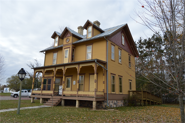
The McGowan House

Having lost his house to fire in 1889, Dr. Emmett McGowan rebuilt his home and furnished it in the Gothic Revival style popular during the period, incorporating several unique decorative elements rescued from the blaze. The nine-room, two-and-a half story house reflects Dr. McGowan’s social standing in the Village of Friendship in the days before the railroad arrived in Adams County.
The Adams County Historical Society, through Wisconsin Department of Transportation and Consolidated Papers Foundation grants, and numerous private donations, presented the newly-restored, partly furnished McGowan House to visitors for the first time in October 1996.
The McGowan House is the site of the Historical Society’s offices, library and archives, and will be open to the public on weekends from May through October.
Visit the Adams County Historical Society! http://www.adamshistory.com
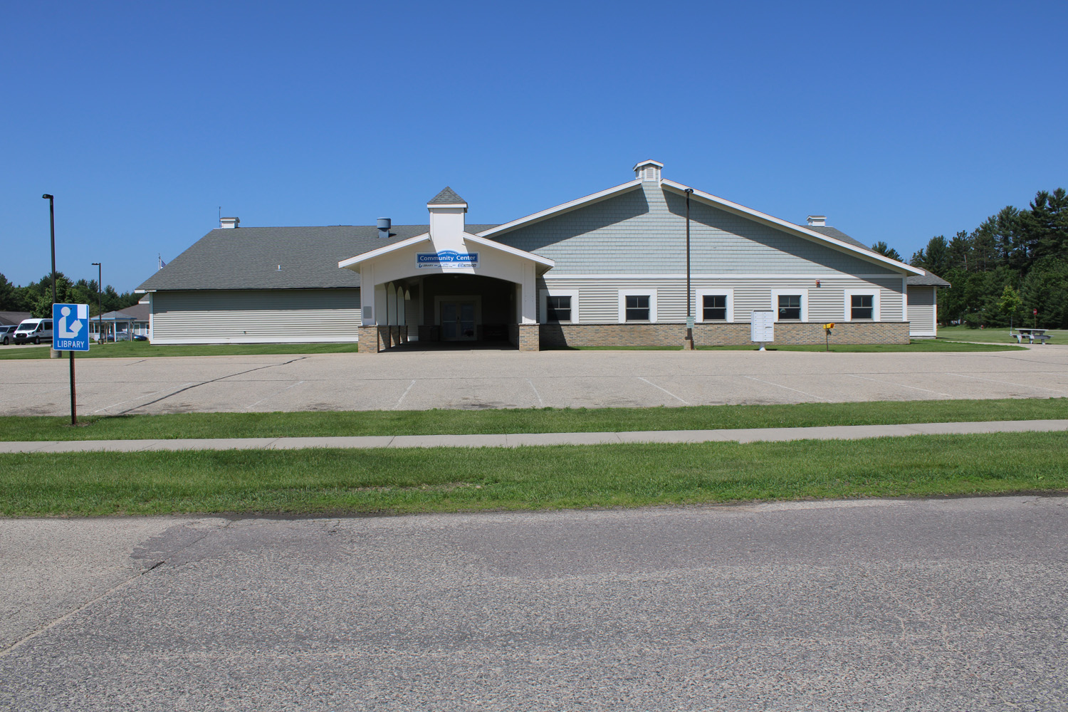
Adams County Library
The Adams County Library is located in the Community Center, 569 N Cedar Street in Adams, WI. The shelves hold over 35,522 books, reference works, CDs, videos, and cassettes. The library also participates in the Inter-Library Loan Program which can place virtually every library book in Wisconsin in patrons’ hands.
An average of 18,008 library patrons check out 4,000 items each month. Over 1,100 children and adults attend one or more of eight summer programs offered at the library, with 285 kids served during the summer reading program alone. The library circulates over 156,314 items per year.
Contact: 608-339-4250
Hours:
Monday, Tuesday, and Wednesday - 9:00AM to 7:00PM
Thursday - 1:00PM to 7:00PM
Friday - 9:00AM to 5:00PM
Saturday - 10:00AM to 2:00PM
Sunday - Closed

The Van Kuren Trail
Named after Gilbert Van Kuren, an early settler to the area, the Van Kuren Trail is located in the town of Strongs Prarie. Lake Van Kuren was a backwater of the main Wisconsin River Channel and was eventually inundated as a result of the construction of a dam and the creation of Petenwell Flowage in 1949.
The Van Kuren Trail is a 2.7 mile year round trail that meanders through rolling landscape, winding through stands of oak and pine, and affording views of wetlands and the 23,000 acre Petenwell Flowage. Quiet observers will see a variety of birds and other wildlife. Interpretive markers along the trail provide explanations of some of the unique features and near the midpoint, a shelter and fire ring is provided. The Van Kuren Trail is located in western Adams County off Chicago Avenue in Strongs Prairie.
Quincy Bluff and Wetlands Natural Area
Quincy Bluff is located in what the first inhabitants called "the valley by Chicoongrah (window in the rock)." It is a unique 10,500 acre natural area jointly administered by the Wisconsin Chapter of The Nature Conservancy and the Wisconsin Department of Natural Resources.
It contains a vast wetland complex sandwiched between sandstone ridges and buttes such as Quincy Bluff, Loan Rock and Rattlesnake Mound. Extensive oak and pine barrens and northern dry forest boarder the preserve. Nine rare plant species and the very rare Karner Blue Butterfly make their homes within the boundries of this ecological treasure.
Quincy Bluff and Wetlands State Natural Area are located in Quincy Township of Adams County, Central Wisconsin and is part of the Central Sands Plains. There is a lot of wilderness with a couple key features like Quincy Bluff, plenty of Wisconsin Wildlife, Lone Rock and a view of Rattlesnake Mound. This public area allows hunting, fishing, wildlife viewing, edible foraging for mushrooms and berries, BUT NOT ALLOWED is camping, vehicles, campfires and non-edible collecting like rocks, fossils etc… It’s also located not far from Castle Rock Lake, Castle Rock County Park, Wisconsin River and Solberg Silver Lake SNA which is also public land open to hunting. Quincy Bluff is about 200 feet in height, but it seems that Lone Rock is more popular for hikers.
Recreational activities such as hunting, fishing, trapping, birdwatching, and hiking are permitted so long as these are resources are not harmed.
Castle Rock County Park
Castle Rock County Park is open year round. This 141 acre park is on the 4th largest body of water in the state of Wisconsin. The park includes a designated swimming area, boat launch, game room, play ground, heated showers and restroom facilities.
Castle Rock Flowage Public Access - Birch's Landing - Boat Landing on Castle Rock Lake. Fish for northern pike, bass, walleye, pan fish and muskie, From Friendship go west on County Hwy J about 6 miles. Turn south on County Hwy Z and drive 1 1/2 miles to the park.
Crooked Lake Public Access - Boat landing - Fish for northern pike, bass and pan fish. From the intersection of Hwys 13 & 82 go west on Hwy 82 to 1st Ave. Drive south 1/4 mile.
Deep Lake Public Access - Primitive boat landing - Fish for bass and pan fish. From the intersection of Hwys 13 & 82 to County Hwy G. Go 1/4 mile north to the park.
Easton Pond County Park - Boat landing on Easton pond where anglers will find northern pike, bass, pan fish and trout. From Friendship, take Hwy 13 south to Conty Hwy A. Go 1/2 mile east on County Hwy A to 11th Drive and turn north.
Fawn Lake Public Access - Fish for bass and trout. From the intersection of Hwys 13 & 82, go south on Hwy 13 about five miles. Turn left on 13th Ave.
Jordan Lake Public Access - Boat landing on the northwest end of Jordan Lake, where anglers will find northern pike, bass and panfish. From the intersection of Hwys 13 & 82 go east on Hwy 82 about nine miles. Go south on County Hwy G about 2 1/2 miles to the park, outhouses and boat landing.
Lake Arrowhead County Park - This 300 acre lake is the site of weekly water ski shows during the summer months. Picnic at the lakeside, launch a boat, or lounge on the beach. Picnic tables, picnic shelter, outhouses, swimming beach, playground boat landing.
Lake Camelot County Park - Anglers will appreciate the bass, northern pike, walleye and pan fish in the 445 acre lake located in the town of Rome. Swimming, boating and water skiing are also popular activities during the summer months. Picnic tables, outhouses, swimming beach and boat landing.
Lake Mason County Park - Boat landing on 855 acre Lake Mason in the town of New Haven. Fish for northern pike, bass, walleye, and pan fish. Outhouses and boat landing are available.
Lake Sherwood Public Access - The smallest of three lakes in the town of Rome, Lake Sherwood attracts anglers for its bass, northern pike, walleye and pan fish. Water skiers and boaters can use the lake. Outhouses and boat landing are available.
McGinnis Lake Public Access - Fish for bass and panfish on 33 acre McGinnis Lake in the town of New Chester. No facilities are available.
Patrick Lake County Park - Formerly a 4-H camp, Patrick Lake County Park now receives little use except by area residents. Its isolated location makes it somewhat difficult to find, but the park offers a quiet spot for picnicking, and provides a swimming beach, playground and a boat landing. Located off County Hwy E and Eagle Dr. Picnic tables, picnic shelter, outhouses, swimming beach, baseball, playground and boat landing.
Petenwell County Park - Open year round with heated showers and rest room facilities. Lake Petenwell is the 2nd largest body of water in Wisconsin. This 431 acre park is on a beautiful lake, game room, designated swimming area, boat launch, playground equipment and hiking trails. 2004 Bighorn Drive, Arkdale.
Roche-A-Cri State Park - The French name refers to the 300-foot high rock outcropping that is the central feature of the quiet park. Climb the stairway to the top for the panoramic view; picnic areas, hiking trails and 41 wooded campsites. 1767 Hwy 13, Friendship.
Leola Marsh Wildlife Area is a 1,860 acre park located 15 miles south-east of Wisconsin Rapids. It can be accessed from County Hwy's D & W. The wildlife area is predominately non-native grassland that formerly was a marsh that has been drained with the many drainage ditches in the first part of the 1900's.
